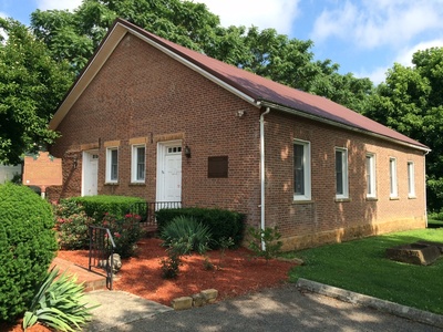
Adams County Genealogy Society
To promote interest and increase the knowledge of those interested in genealogy and to encourage the preservation of family histories by maintaining and making available a library of genealogical records, histories and other related information.
Special library hours 12:00-4:00 p.m. Thursdays and Saturdays are available for those visiting out of town.
P.O. Box 231
West Union, Ohio 45693
Directions/Map
(937) 544-8522
E-mail: acgsoh@yahoo.com
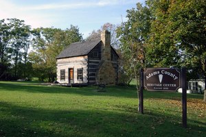
Adams County Historical Society
The Adams County Historical Society mission statement is to preserve the heritage of previous generations, educate future generations and create a better future.
The Society runs the Adams County Heritage Center located on St. Rt. 247 at 507 North Cherry St. in West Union, Ohio. The center includes a genealogical collection, museum, post office, and log house. This is open on Thursday and Saturday from 12:00 P.M. – 4:00 P.M. For more information about the center, call 937-544-8522 during those normal open hours.
507 N. Cherry St.
West Union, Ohio 45693
Directions/Map
(937) 544-8522
Website for Adams County Historical Society
Hours: 12:00 – 4:00 P.M. Thursday and Saturday

Adams County Paleo-Indian District
One of the Largest Paleo Indian Sites in North America which has produced over 100 fluted points.It is believed that the first men came across a ‘land bridge,’ a large land area that connected Alaska and Siberia. They were hunters and gatherers and did no farming. They had no permanent campsites and were in the constant pursuit of game. Archaeologists have no definite proof but believe that these Pa leo-Indians entered the Ohio region as early as 11,500 B.C.The Paleo-Indians may have entered Adams County from the north and west. Several of their distinctive ‘fluted’ points have been found in the county. Since they are the only people to utilize the fluted point, these early hunters are known as the Fluted Point Complex.About 9,500 B.C. another group of Pa leo-Indians moved into the Brush Creek Valley and intermingled with the Fluted Point Complex. They are known as the Plano Complex. Their weapons differed from their predecessors’. The once popular fluted points gave way to the un fluted and stemmed varieties. All spear points and tools are considered rare since the Pa leo-Indians were of a nomadic nature having no permanent villages or kill sites.
Address Restricted
Sandy Springs Vicinity
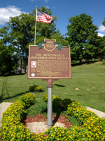
Bentonville Anti-Horse Thief Society Monument
The Anti-Horse Thief Society has been in existence since 1853. It was originally created to retrieve stolen horses and bring the thieves to justice. The monument was placed in Bentonville in 1961.
State Route 41
Bentonville, Ohio 45105
Directions/Map
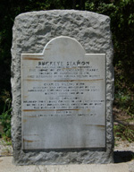
Buckeye Station
Buckeye Station was built by General Nathaniel Massie in 1797. The home was one of the oldest frame houses built in the State of Ohio. General Massie lived in this home until about 1802 when he sold it to his brother-in-law, Charles Willing Byrd, Secretary of the Northwest Territory. This old home was located on Possum Hollow Road. A monument can be seen on U. S. Route 52 just east of Manchester, Ohio.
East of Manchester off of U.S. 52
Manchester, Ohio 45144
Directions/Map
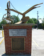
Cairn of Peace
This monument commemorated the World’s Plowing Match held near Peebles in 1957. The monument is an exact replica of a 12th century European plow. Northern Ireland, Sweden, Germany, New Zealand, and many other countries came together peaceably for a common purpose. The grounds covered 2,000 acres and took in 17 farms. One-hundred and forty exhibitors set up displays for the five-day event.
Main Street
Peebles, Ohio 45660
Directions/Map
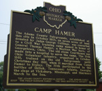
Camp Hamer
The Adams County Fairgrounds, established at this site in October 1853, on seven acres of land donated by Judge George Collings, was converted to a Civil War training camp named in honor of General Thomas Hamer, a Mexican War hero, of Georgetown, Ohio. The old stone Courthouse was made into a hospital to serve the camp. The 70th Ohio Volunteer infantry, organized in October 1861, trained on the old fairgrounds until Christmas day 1861, when it marched from Camp Hamer to Ripley. The 70th participated in the battles of Shiloh, Tennessee; Atlanta, George; the siege at Vicksburg, Mississippi, and Sherman’s March to the Sea.
The corner of West and South St.
West Union, Ohio 45693
Directions/Map
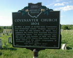
Covenanter Church Historical Marker
Marks the site of the original church building. It is about one-quarter mile south of the village on State Route 136 in the Village cemetery.
St. Rt. 136
Cherry Fork, Ohio 45618
Directions/Map
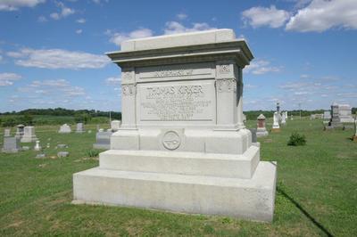
Governor Thomas Kirker, Homestead & Gravesite
The hewn stone section of the house is the original home of Ohio’s second governor. It was erected in 1805. The stonemason was Thomas Metcalf, later a governor of Kentucky. It is located on State Route 136 and Township Road 21. The two-story addition, now the front of the home, was built in 1852 by George Kirker, son of the governor. George Kirker later served as a Captain in the Civil War. It is privately owned.
St. Rt. 136
West Union, Ohio 45693
Directions/Map
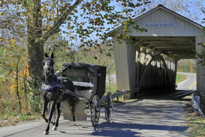
Harshaville Covered Bridge
The Harshaville Covered Bridge is the last covered bridge still used in Adams County. It was built before the Civil War, circa 1855, and was used by Confederate General John Morgan and his Raiders when they passed through the county during the Civil War. It is on Graces Run Road in Harshaville.
6450 Graces Run Road
West Union, Ohio 45693
Directions/Map
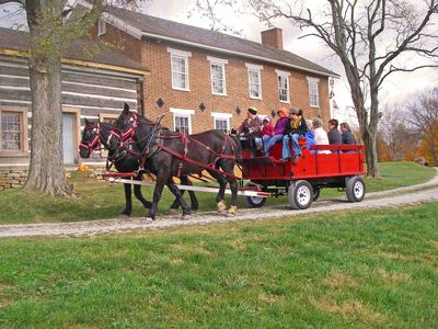
John T. Wilson Homestead
After nearly six years and countless hours of tireless and dedicated work, Ralph and Patricia Alexander held the long-awaited dedication at the historically renovated John T. Wilson Homestead in Tranquility in 2012. The two-story brick home built in the 1840’s was known as “Prominence” and was a stop on the National Underground Railroad.
According to Alexander, who has researched the original owner’s history, Wilson, who lived from 1811 to 1891, was a local store merchant and fervent abolitionist. At age 50, Wilson gathered the initial 62 men of Company E, and as part of the 70th OVI, led the men into battle at Shiloh. Wilson later served in the Ohio Senate and U.S. Congress.
When the Alexander’s purchased the Wilson Home 2006 the structure was in a state of disrepair. Reconstruction of the historic home took nearly six years with the ultimate goal to ensure its history is recognized and preserved.
At the dedication the Alexander’s were presented with a commendation from the 129th General Ohio House by State Representative Danny Bubp, and recognition from The Friends of Freedom Society. The state flag raised at the dedication was donated by State Senate President Tom Niehaus. For information about the Wilson home go to www.johntwilsonhomestead.com
* The John T. Wilson homestead is a nationally registered and historic landmark.
92 Old State Route 32
Peebles, Ohio 45660
Directions/Map
(937) 386-0143
Website for John T. Wilson Homestead
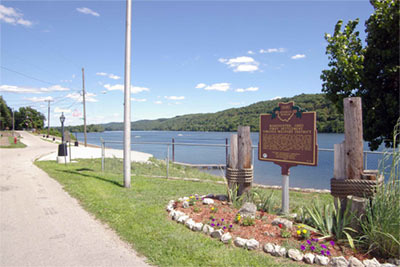
Kinfolk Landing – Ohio River & Historical Marker
Manchester’s boating ramp to the Ohio River. The Ohio River is 981 miles long, starting at the confluence of the Allegheny & the Monongahela Rivers in Pittsburgh, PA, and ending in Cairo, IL, where it flows into the Mississippi River. The Ohio river offers approximately 164 species of fish to the avid angler. During the Summer and Fall months large Paddlewheelers travel the river.
‘Manchester, Ohio – First Settlement-Virginia Military District’In 1784, the state of Virginia ceded all of its Northwest Territory to the federal government except for this tract to satisfy the land bounties owed to its Revolutionary War soldiers. The Virginia Military District extended from the Scioto River in the east to the Little Miami River in the west, and from the Ohio River on the south to the town of Kenton in the north. The District contained over 4 million acres of land. Nathaniel Massie founded Manchester, which is the fourth oldest settlement in Ohio, as a base for his surveying operations. Manchester, sometimes called Massie’s Station, was founded in 1791, populated largely by settlers coming from Kentucky and Virginia.
6352 US 52
Manchester, Ohio 45144
Directions/Map
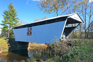
Kirker Covered Bridge
Completed Circa 1890. This is the second to last-covered bridge to be used in the state highway system. It is no longer in use but can be seen from St. Rt. 136.
7430 HWY 136 – SW of West Union off of State Route 136
West Union, Ohio 45693
Directions/Map
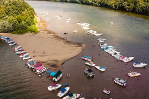
Manchester Islands
In earlier times there were three islands, but only two remain. Legend has it that often the Indians would disguise themselves as white men and ambush settlers who were traveling the Ohio River. They are now a National Wildlife Refuge under the supervision of the U. S. Fish and Wildlife Service.
Ohio River
Manchester, Ohio 45144
Directions/Map
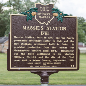
Massie Station Historical Marker
The settlement where Nathaniel Massie and his followers erected several cabins within a fort complete with blockhouses for defense against the Indians by 1791.
US HWY 52 and Cemetery Ave
Manchester, Ohio 45144
Directions/Map
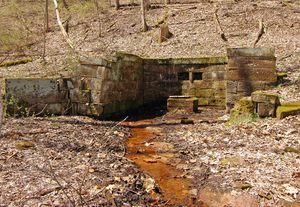
Mineral Springs
The medicinal value of the springs was first promoted by Charles Matheny in 1840. In 1864 the first hotel and resort was built at that location and was named “Sodaville”. Mineral Springs Health Resort, nationally known for its large hotel complex and recreational facilities, was destroyed by fire in 1924. A smaller hotel was built a quarter mile north of the original site and continued operation through 1940.
Near The Intersection of Mineral Springs Road and Peach Mountain Lane.
Mineral Springs, Ohio 45660
Directions/Map
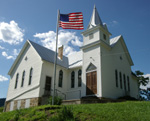
Moore’s Memorial Chapel
The present structure is located on the original site of the first Methodist Church built in Ohio and the old Northwest Territory. The original church building was erected in August of 1800. Rev. Joseph Moore organized the church in 1795 or 1796. The pulpit was constructed from sixteen kinds of native wood.
2523 Township Highway T-162A – Located 1/4 mile up Wintersteen Run
Blue Creek, Ohio 45616
Directions/Map
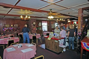
Olde Wayside Inn
Home cooked meals at the historic “Bradford Tavern” built in 1804. A registered Ohio historical landmark. The Olde Wayside Inn was originally built by General David Bradford in 1804 and was known as Bradford’s Tavern. The inn is of log construction. General Andrew Jackson and Mexican General Santa Anna were entertained here. The Olde Wayside is still used today providing home cooked meals.
222 W Main St.
West Union, Ohio 45693
Directions/Map
(937) 544-7103
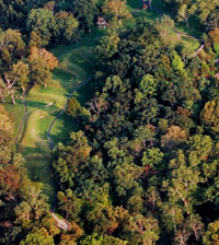
Serpent Mound
Serpent Mound is one of the few effigy mounds in Ohio. It is the largest and finest serpent effigy in the United States. The museum contains exhibits on the mound and the geology of the surrounding area, known as the Serpent Mound crypto explosion structure. It is located on State Route 73 six miles north of State Route 32. It is operated and maintained by the Ohio Historical Society. Serpent Mound is open year round, although hours vary with the seasons. Museum hours also vary. There are special hours for schools and other groups by appointment.
Features a short, 1/4-mile, trail that winds downhill to the Brush Creek valley. Considered a moderate hike, the trail is at its best during the early spring when Trilliums cover the hillsides.
Please call (937) 587-2796 for more information.
Serpent Mound State Memorial
3850 State Route 73 (5 miles NW of Locust Grove on State Route 73)
Peebles, Ohio 45660
Directions/Map
1-800-752-2757
Website for Serpent Mound
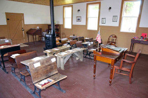
Page One-Room Schoolhouse
The Page one room schoolhouse was built in 1827 and for over 100 years served as a schoolhouse. The school was closed in 1941 and thereafter served as a residence for many years until the Adams County Retired Teachers Association purchased the historic school building to restore it and open it as a museum. The schoolhouse is located north of West Union off SR 41 at the intersection of Page School Rd. and Vaughn Ridge Road. For more information contact the Travel & Visitors Bureau at (937) 544-5639.
Page School Rd. and Vaughn Ridge Rd. – Corner of Page School Road and Vaughn Ridge Road
West Union, Ohio 45693
Directions/Map
(937) 544-5639
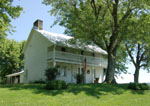
The Treber Inn
Erected in 1798, a two-story log structure built by gunsmith John Treber, one of the oldest documented buildings standing in the state. For over four decades it served as a wayside inn and stagecoach stop on Zane’s Trace, Ohio’s first authorized road (SR 41). Listed on the National Registry of Historical Places, N of West Union on SR 41, privately owned and not opened to the public.
St. Rt. 41
West Union, Ohio 45693
Directions/Map
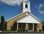
West Union United Presbyterian Church
The West Union United Presbyterian Church was built of hewn stone in 1810. The stonemason was Thomas Metcalf who later became Governor of Kentucky. Governor Thomas Kirker was instrumental in getting the church built. This is the oldest church structure in Ohio still in use as a church.
104 S Second St.
West Union, Ohio 45693
Directions/Map
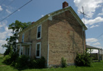
Wickerham Inn
This brick home was originally a tavern built by Peter Wickerham in 1801 on Zane’s Trace. When Morgan’s Raiders passed through the county in 1863, Confederate soldiers slept at this Inn. This is possibly the oldest existing brick structure in Adams County. It was used as the headquarters during the World’s Plowing Match held 1957. It is located on State Route 41 between Peebles and Locust Grove. It is a private residence.
St. Rt. 41
Peebles, Ohio 45660
Directions/Map
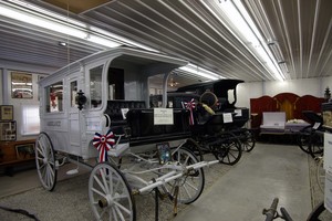
William Lafferty Memorial Funeral and Carriage Collection
The collection consists of antique hearses and other funeral service vehicles, both motorized and horse-drawn. The horse-drawn vehicles and memorabilia date from 1848. The collection is dedicated to James William Lafferty (1912- 1987), the 4th generation of the Lafferty family to serve West Union and surrounding areas of Adams County in the funeral business. Due to his preservation of family carriages and to his acquisition of additional funeral vehicles, this collection is available for your viewing and interest. The collection is open on Saturday from 10:00 a.m. to 2:00 p.m. or by chance or appointment.
205 S Cherry St.
West Union, Ohio 45693
Directions/Map
(937) 544-2121
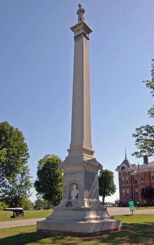
Wilson’s Soldier’s Monument
The Wilson’s Soldier’s Monument was erected in 1893 as a memorial to the men of Adams County who died in the Civil War. The monument stands in front of the Wilson’s Children Home. Both the home and the monument were donated to the people of Adams County by the Hon. John T. Wilson of Tranquility. Wilson lost his only son in the Civil War. Adams County’s own Drummer Boy of Shiloh, Col. John A. Cockerill, unveiled the monument June 10, 1893.
300 N Wilson Dr.
West Union, Ohio 45693
Directions/Map
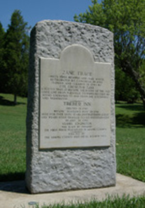
Zane’s Trace Monument
Ohio’s 1st highway and mail route authorized by Congress in 1796, marked and cleared in 1797 by Col. Ebenezer Zane, it became the route of the old stage line from Maysville to Wheeling used by statesman traveling to and from the Southwest and Washington D.C. Monument located North of West Union on SR 41 before Dunkinsville.
St. Rt. 41
Dunkinsville, Ohio 45660
Directions/Map
